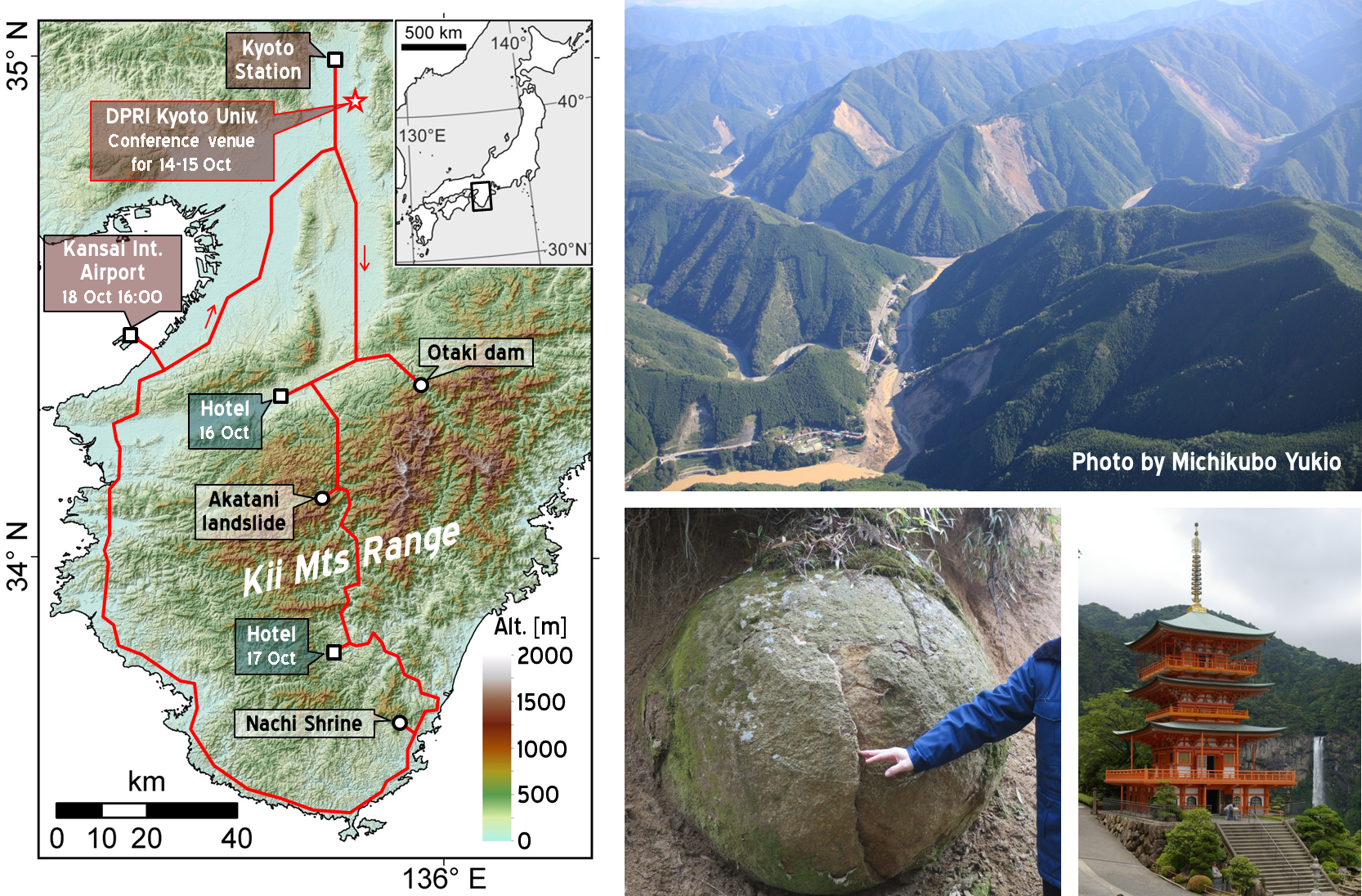
Field trip
Post-conference excursion to Kii Peninsula
(Nara and Wakayama Pref.)
16-18 Oct 2017
The Kii Mountains are located on outer arc of the southwest Japan, underlain by accretionary complexes and granitic rocks. The area has been actively uplifting and is deeply incised by rivers, and hence exhibits a mountainous landscape. Hillslopes are basically steep and have high-relief, but relatively gentle, low-relief topography remains on higher altitudes, which may be remnants of paleo-landforms. This area receives intense orographic rainfall by monsoonal activities and typhoons, and has been subjected to repeated seismic shakings by the Nankai Trough Earthquakes with ca. 100-yr intervals. Hazard of deep-seated catastrophic landslides has been a threat for the local community in this region. The latest disaster occurred in 2011 by typhoon Talas, with more than 70 of large rock avalanches, forming barrier lakes in V-shaped valleys. In this field trip, we are going to observe several landslide sites in this event, and discuss geologic, topographic, and hydrological factors controlling the occurrence of deep-seated landslides and preceding gravitational hillslope deformations and spheroidal weathering.
The Kii Mountains are main part of Kumano Kodo Pilgrimage Routes (UNESCO World Heritage), including many historical places. We will also
visit some of Grand Shrines during the trip.
Excursion route
Open the route map on Google Map
Tentative plan
16 Oct 2017
8:30 Kyoto Station
11:00~11:30 Otaki-Dam, Yoshino River
11:40~12:10 Terao area (gravitational hillslope deformation)
12:20~13:00 Lunch break
13:10~14:30 Shiraya area (a slow-moving landslide caused by reservoir impoundment)
16:00 Hotel
17 Oct 2017
8:30 Hotel
10:00~10:20 Nakahara area (fluvial knickpoints and surrounding topography)
10:40~11:20 Ui-Shimizu area (rock avalanches in 2004 and 2011)
11:30~12:20 Lunch break
12:40-13:10 Akatani East (a rock avalanche in 2011)
13:30- 15:00 Akatani (a rock avalanche in 2011)
16:30 Hotel (Japanese style)
18 Oct 2017
8:30 Hotel
9:20~9:30 Distant view of an outcrop of granite porphyry (columnar joints and spheroidal weathering)
10:30~11:20 Visit to the Sediment Disaster Prevention Research Organization
11:40~13:00 Observation of a landslide site with spheroidal weathering
13:20~14:00 Lunch Break, Nachi Falls and Nachi Shrine (historical place,
a part of the UNESCO World Heritage, Kumano Kodo Pilgrimage Routes)
16:00 Kansai International Airport
18:00 Kyoto Station